Update of Day 4, 5th July 2019 - Bembridge to Shanklin
Bembridge to Shanklin

Another 9 miles this afternoon, leaving Bembridge just after 2pm and heading for Shanklin.
I would have liked to go a bit further today but the weather was overcast with a cool breeze, against me again, also the tidal flows were not ideal for passing the two headlands after Shanklin.
Fairly calm sea at first. The sea matched the sky, looking grey, becoming slightly choppy and uninviting for the first hour, making me think that ending up in the water here would be very different from the practice capsizes in Christchurch Harbour.
I passed through two areas of rough waters, one when I found myself in a rough and noisy patch of water. I had accidently cut the corner of Bembridge Ledge, a rocky ledge that extends about 400metres from the headland at the most easterly point of the Island, thinking that with the height of the tide, I should have around 6ft of water beneath me. I looked quickly at my 'chart plotter' (an old ipad with marine charts loaded that I used from time to time) and saw SHARPUS ROCKS. Swear word and rowed into deeper water quickly (my route is the yellow line).
In this photo of the chart screen, yellow is the shore, green areas dry at low water and blue - white are always water.

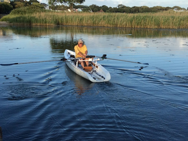
The other rough patch was a small area of overfalls just off Culver Cliff headland (see photo, taken after passing the rough patch).

As I went into Sandown Bay the seas calmed and I had a more relaxed row past Sandown Pier and beach to the southern end of Shanklin prom, where we pulled the boat up a slipway and chained it to a post for the night.
About 2 hours 20 minutes rowing today. Making progress but now a day behind original schedule.
Then collected some local knowledge about the next headlands, Dunnose Point and St Catherine’s Point - do they really know or are they making it up???

To see a video of todays row:


Comments
Post a Comment